Using Data for Disaster Maps
In the second week of my placement at the British Red Cross, I have been helping to make a flooding map of Southern Africa. We have been marking out the areas affected by flooding, cyclone and cholera in Southern Africa in the past 5 years (see below). As I mentioned last week, the GIS team support the work of the Red Cross both here in the UK and abroad.
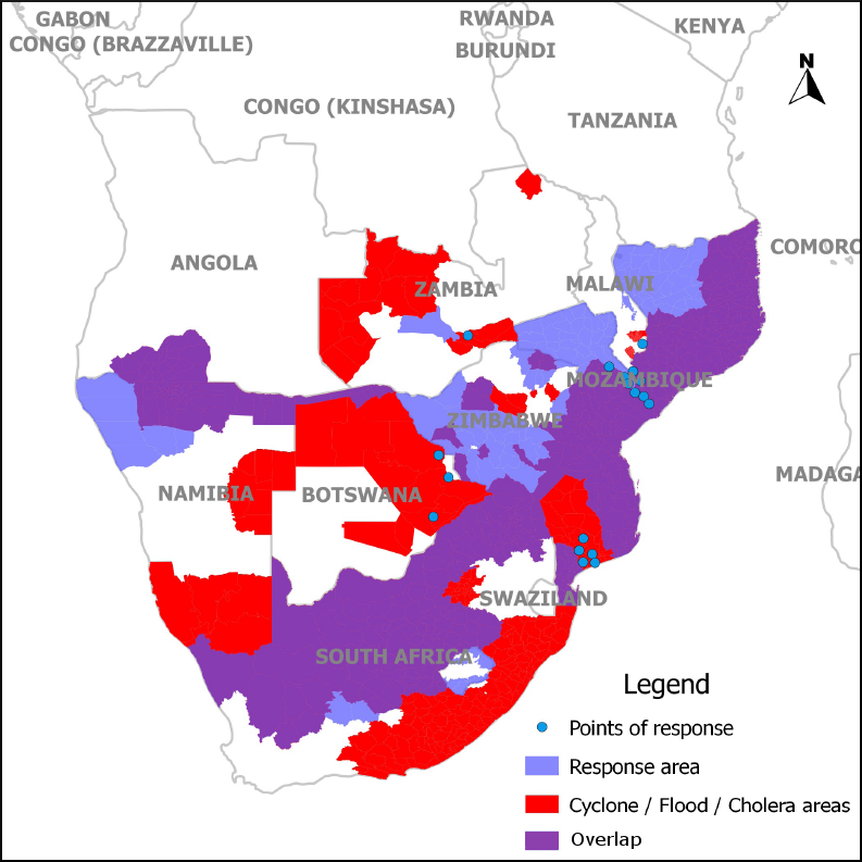
The map is to help the logistics team decide where to put equipment warehouses containing non-food equipment for disaster relief. Other factors to consider include access to transport links and the political context.
Challenges Accessing Data: US government shutdown
One major challenge this week has been accessing climate and weather data from US government websites. This data is usually freely available online, but due to the ongoing political crisis in the US, some major government websites have been closed down.
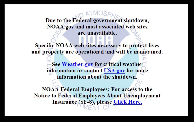
The NOAA (National Oceanic and Atmospheric Administration) website (above), for example, usually provides weather information, but the website is totally closed. Most websites from the US Geographical Survey (USGS) are also closed down, which usually provides information on natural hazards and earthquakes. A message on the USGS website states: “Only web sites necessary to protect lives and property will be maintained.”
What happens to early warning systems during a US government shutdown?
All this has made me wonder, what has happened to global disaster early warning systems during the US government shutdown? Are these early warning systems able to function properly?
Early warning systems are vital for early response before a disaster strikes. Luckily, the ‘National Hurricane Center’ remained partially active during the threat of Hurricane Karen last week, and fortunately this hurricane was not serious in the end. However, international weather data is not available that would usually be available, and it has been reported that these websites are understaffed.
It seems that the USGS earthquake feed is also not working at the moment. Unless critical data is available, the US government shutdown could be not only inconvenient, but could also potentially endanger people’s lives.