This week, I started my placement at the British Red Cross in London. The GIS team play an important and vital role here in the work of the British Red Cross, providing map services to the other departments.
At the start of the week, I joined a corporate strategy meeting and found out about the seven fundamental principles that guide the work of the Red Cross, which include neutrality and impartiality. British Red Cross strategy is formed through an inclusive process of stakeholder engagement.
Back at the GIS team, I have been getting to know the British Red Cross mapping tools and systems. Geographic Information Systems (GIS) are a powerful tool that can be useful in humanitarian work.
Maps are useful in disaster and emergency situations to visualise affected areas and organise the allocation of humanitarian resources. The GIS team here work closely with the national and international teams to provide any maps they need. For example, last week the team made a security map of Nairobi after the Westgate Mall terror attacks.
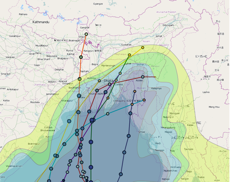
With an increase in climate-related disasters in recent years due to climate change, the Red Cross is also building up knowledge in use of climate and weather information in order to anticipate future disasters.
Overall, it has been a busy and exciting week and I am really excited about working here at the Red Cross. …More to follow next week!
One comment for “Mapping Disasters at the British Red Cross”